Ancient Gaza
Historical & Geographical Preview:
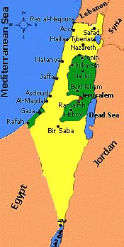
Gaza is one of
the oldest cities in the world. The city is strategically situated between two continents,
Asia and Africa. This geographical location made the city acquire a strategic and
extraordinary military status; it is the southern front defense line not only of Palestine
but of all Sham area (Syria, Lebanon, and Jordan) as well. It is also, the east
northern advanced defense line of the Egyption depth. consequently, the city had
been a battle field for most of the ancient and recent empires, the Pharaonic, the
Assyrian, the Persian, the Greek, the Roman, the Crusades, and during the First World War.
Gaza has an
important strategic location between the continents of Asia and Africa. This important
location made Gaza a vital entrance to the most important trade and military route in the
world. This route was known as "Via Mars - Sea Route" or "Horas
Route". This route connects Palestine with Egypt on one side, and the Arabian
Peninsula and Southeast Asia on the other; it also connects all of these areas with Europe
through the Mediterranean.
Situated at the
climate division line and the latitude 31.3 degree north to the Equator. Gaza has occupied
a dividing position between the desert in the south and the Mediterranean climate in the
north. This location, as such, had made the city acquire the role of a prosperous trading
market for world products, both tropical, and cold. This importance was reinforced by its
distinguished position on a hill, 45m above sea level and within a range of 3 Km. away
from the sea. The Area of ancient Gaza was about 1 Km. square, it was situated over hill
and surrounded by a large wall with four gates in the four directions.
The Sea Gate
(Memas) in the west, Asklan Gate in the north, Hebron Gate in the east and El-Daroom in
the south.
The names
given to the these gates were changing in accordance with the changing consecutive
empires. Those gates used to be closed at sunset, therefore the city inaccessible
fortitude against the enemy.
Due to all
these powerful factors, our ancestors, the Arab Cana'nites established the city and called
it Gaza around the year 3000 BC. The Arab Minions who resided in Gaza, gave it the same
name. They helped in reviving the city and had strong ties with Gaza citizens as Ma'an
merchants were married to Gazans. The Pharaohs, during the reign of the Pharaoh III,
1447-1501 BC., gave it the name Gazatwa which is related to the treasures said to be
buried by Cambayses during the Persian rule.
The name Gaza
remained immortal without any change and the Arab associated it with Hashem, the name of
Prophet Mohammad's granfather, (peace be upon him) to become Gazat Hashem. Hashem Ben Abed
Manaf died in the city during one of his trading journeys round the end of 6th
century.
It is not
strange however, that the city was described as the Kings Tunnel and the Gate between
Africa and Asia by Napoleon Bonaparte.
|