Destroyed Palestinian Villages:
A Reign Of Terror & Systematic Expulsion
Lifta
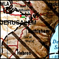
The village stood on the slope of a steep hill with a spring and faced north-northwest, overlooking Wadi Salman (approx. location at  on map). The Jerusalem-Jaffa highway ran immediately southwest of it past rock-cut tombs, and dirt paths linked it to a group of neighboring villages. Although the identification of the village has been debated by biblical scholars, Lifta is believed to have been established on the site of Mey Neftoach (Mey Nephtoah), a source of water near Jerusalem (Joshua 15:9). The site retained this name during the Roman period and was called Nephtho during the Byzantine era. Almost nothing is known about the village in the early Islamic period, but during the Crusades, the village was referred to as Clepsta. In 1596, Lifta was a village in the nahiya and liwa' of Jerusale with a population of 396. It paid taxes on a number of crops, including wheat, barley, olives, and fruit, as well as on orchards and vineyards. In 1834, the village was the site of a battle in which the Egyptian army under Ibrahim Pasha defeated local rebels led by a prominent local ruler, Shaykh Qasim al-Ahmad.
The village houses were built mainly of stone, and the old streets of the village ran along the contours of the hill. The village expanded markedly towards the end of the Mandate: Construction spread east, up the slope of Mount Khallat al-Tarha, until the village abutted the Rumayma neighborhood in the northwestern quarter of West Jerusalem. Construction also expanded towards the foot of the hill in the south and southwest, along the Jerusalem-Jaffa highway. In mid-1940, Lifta's population was predominantly Muslim, with the number of Christians estimated at 20 out of a total of 2,550. The village had a mosque, a shrine for Shaykh Badr (a local sage), two coffee houses, a social club, and a few shops at its center. It also had an elementary school for boys and one for girls. The village was in effect a suburb of the city of Jerusalem and its economic ties with the city were strong. The farmers of Lifta marketed their produce in Jerusalem markets and took advantage of the city's services. The rainfed agriculture (including grains, olives and fruits) of the village was concentrated in Wadi al-Shami, in the depressions lying to the southwest of the village, and on the slopes. In 1944/45 a total of 3,248 dunums were planted in cereals.
The fighting in Lifta, as well as the adjacent Jerusalem districts of Rumayma and Shaykh Badr, was initiated by the Haganah in the earliest days of the war. The History of the Haganah states that, "Securing the western exit of the city [of Jerusalem] entailed the eviction of Arabs from Romema and Shaykh Badr. Afterwards, the Arabs also vacated Lifta." Other sources supply further details. According to Israeli historian Benny Morris, the Haganah fired the first shots in December 1947, killing one Lifta resident who was suspected of informing Arab forces about the departure of Jewish convoys to Tel Aviv. The next day, a grenade was thrown at a Jewish bus. Palestinian historian 'Arif al-'Arif adds that a coffeehouse in Lifta was attacked on 28 December by members of the Stern Gang armed with automatic weapons and grenades, killing six and wounding seven.
Al-'Arif writes that most of the residents of Lifta left after the attack on the coffeehouse. The remaining civilians evacuated after subsequent attacks by the Haganah, Stern Gang and Irgun Zvai Leumi (IZL). In neighboring Shaykh Badr, the Haganah blew up the house of the Mukhtar on 11 January, and two days later launched a second raid in which twenty houses were damaged. Most houses on the eastern periphery of Lifta were also demolished. Morris adds that the purpose of these demolitions was to turn the Palestinian residents out of their homes and that this goal was achieved. By 7 February 1948, Jewish Agency chairman (and future Israeli Prime Minister) David Ben-Gurion expressed his satisfaction with the results of the attacks at a meeting of Mapai party leaders: "From your entry into Jerusalem through Lifta-Romema, through Mahane Yehuda, King George Street and Mea Shearim-there are no strangers [i.e. Arabs]. One hundred percent Jews."
The settlements of Mey Niftoach, Giv'at Sha'ul, and Giv'at Sha'ul Bet were built on village lands and are now suburbs of Jerusalem (Return to map above). These settlements also occupy parts of Dayr Yasin. Romema--which shared a border with Lifta--is still a Jerusalem neighborhood, located north and slightly east of the central bus station (approx. two kilometers north of the Knesset).
Most of the houses remaining on the site are deserted, although some have been restored for the use of Jewish families. A basin that had been built around the spring in Wadi al-Shami lies in ruins. The mosque and the village club are still visible, north of the spring. Adjacent to the mosque, on the western side, is a cemetery covered with bushes and wild grass. The village orchard of fig and almond trees is located at the bottom of a wadi along a stream flowing from the spring. Jewish families have moved into three of the old village houses. The ruins of other houses are visible in various parts of the site. In 1987, the Israeli Nature Reserves Authority announced it would restore the "long-abandoned village" and to turn it into an open-air natural history and study center that would "stress the Jewish roots of the site." This project, with an estimated cost of $10 million, would be financed by donations.
Return to Destroyed Palestinian Villages index.
| About CRDPS | Race Against Time Project | CRDPS Archives |
| Complete Guide to Palestine's Websites - Academic & Research listings |
Material compiled by Rami Nashashibi, June 1996.
Page design by Birzeit Web Team, March 1997.
Center for Research and Documentation of Palestinian Society, Birzeit University, P.O. Box 14, Birzeit, West Bank, Palestine.
Tel: +972-2-998-2975, Fax: +972-2-995-2975, E-mail: center@research.birzeit.edu.