Welcome to:
Welcome to:
Shuqba
The Quintessential Palestinian Village
new! People from Shuqba on the Internet
**Special thanks to Mr. Adam Shalash and Mr. Issa Shalash (two fellow Shuqbans) for some of the photos below
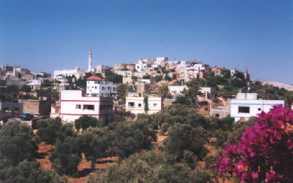
A view from the southwest. The village is centered on the hill at the top. the olive trees in the front are part of an area called Wad al Zaytun (the Valley of Olives)
[Where Is It?] [History] [Daily Life]
The village of Shuqba is located northwest of Jerusalem inside what is commonly called the West Bank. The West Bank, along with Israel and the Gaza Strip, comprise the land known for over 2,000 years as Palestine. According to what is commonly referred to as the "two-state solution" to the Palestinian-Zionist conflict, Palestinians are entitled to a state comprised of the West Bank, Gaza, and East Jerusalem (less than 30% of their original homeland) while Israel keeps the rest of historic Palestine. This will be determined by the Oslo Peace Accords signed in 1993 but, to date, Israel has not even agreed to even hand over a majority of the West Bank and East Jerusalem.
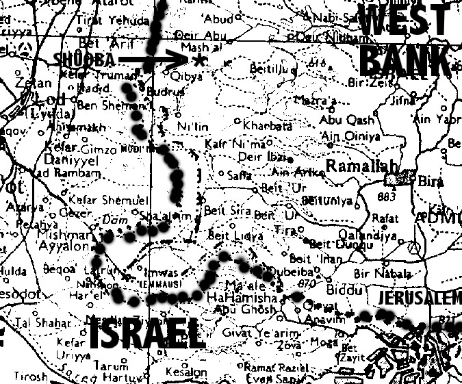
You will probably not find Shuqba on most maps but it is located about 15 kilometers northwest of Ramallah, about 30 kilometers northwest of Jerusalem and a just a few kilometers from the "Green Line" that separates Israel from the West Bank. Al-Lyd (Lod) and Al-Ramla (Ramle) are directly across the Green Line and are only a few minutes drive away once you've crossed the Green Line. For a detailed map, click here. Shuqba stretches over several hills and the valleys between them. Besides the other surrounding Palestinian villages, several Israel settlements (illegal under international law) and bypass roads surround Shuqba. They were built on lands confiscated or bought (through dubious means) from Shuqba and the other Palestinian villages. To read more about a neighboring village's experiences, click here. In September 1997, over 300 olive trees belonging to Shuqba were uprooted to make way for a proposed settler bypass road. In 1999, more land was confiscated near the main entrance to the village.
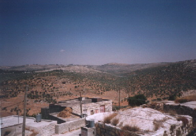
The areas northeast of Shuqba. On the horizon is the village of Deir Abu Meshal. In between are olive trees owned by the two villages. The houses in the foreground are some of the oldest in the village- some dating back over a century.
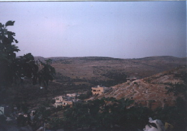
The areas north of Shuqba. The uncompleted building near the center is the new girls' school The main road into the village is next to the houses on the side of the hill.
After Ariha (Jericho), Shuqba is believed to be one of, if not the oldest, village in Palestine. The many ruins around Shuqba (see below) are proof of these very ancient beginnings. Specifically, there is a nearby cave that was used by our ancient ancestors. Before the Intifada (uprising) tourists from all over the world often used come to see it for its archeological and historical value.
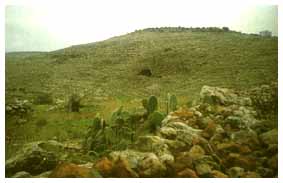
the famous Shuqba Cave
The cave lies on the northern bank of Wadi Al Natuf, in the Ramallah area. It was formed by karastic activity. Here were first discovered the remains of the Natufian culture that was named after the Wadi. This culture dates to the middle of the Paleolithic period (10000-8000 BC). Natufian culture is defined by an assemblage which includes microlithic components of complex tools. Natufians may have moved within a territory to exploit their resources most effectively but they certainly maintained base villages. The cemeteries of el-Wad, Shuqba, Eynam and Nahal Oren contained 87, 45, 82 and 50 burials respectively. Considering the small size of these sites, archeologists agree that the occupation must have been for a considerable time.
As for the name "Shuqba", one theory says it named for its founder, Shaqeeb, but the name got corrupted over the centuries. Another theory says the name was originally 'Shaqfa", which was later corrupted to "Shaqba", which finally became Shuqba.
Shuqba, like the rest of Palestine, was once part of the Roman Empire, then the Islamic Empire, the Ottoman Empire and earlier this century, a British Mandate that ended in 1948.
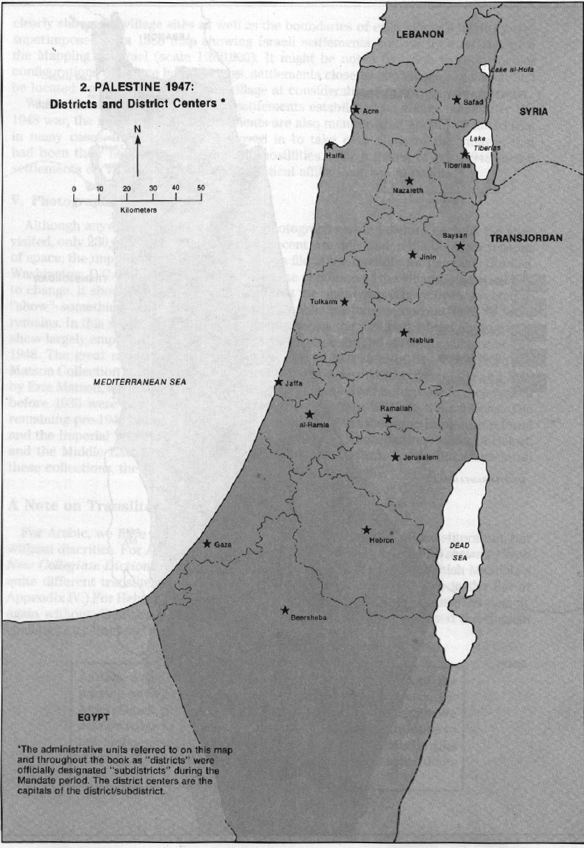
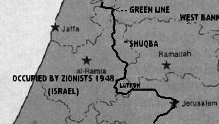
Until 1948, Shuqba was part of Al-Ramla district. This district stretched from the coast, south of Yaffa (Jaffa), to the hills of central Palestine, around the Latrun area.
During the 1948 war, Zionists occupied most of the district except for a handful of villages in the far east and the Latrun salient. Most of the occupied Palestinian villages of Al-Ramla district were subsequently depopulated and destroyed by Zionist forces. The three villages of the Latrun were later destroyed in 1967 and their lands were annexed. In fact, a few families from the destroyed village of Beit Nabala settled in Shuqba. The Green Line that was drawn to separate the areas occupied by Israel from the remaining areas was drawn just west of Shuqba's village lands. Shuqba and the few other remaining villages were later incorporated into the Ramallah district of what became the Jordanian-controlled West Bank.
On October 14, 1953, a neighboring village, Qibya, was attacked by an Israeli military force led by Ariel Sharon (who is now an Israeli politician). Upon arrival, it was surrounded and cordoned off from all of the neighboring Palestinian villages. The attack began with concentrated, indiscriminate artillery fire on the homes in the village. This continued until the main force reached the outskirts of the village. Meanwhile, other forces headed for nearby Arab towns like Shuqba, Budrus and Na'lin in order to distract them and prevent any aid from reaching the people in Qibya. They also planted mines on various roads so as to isolate the village completely. As units of the Israeli infantry were attacking the village residents, units of military engineers were placing explosives around some of the houses in the village and blowing them up with everyone in them under the protection of the infantrymen, who fired on everyone who tried to flee.
These acts of brutality continued until 4:00 a.m., October 15, 1953, at which time the Israeli forces withdrew to the bases from which they had begun.16 There was a particular sight the memory of which remained in the minds of all who saw it: an Arab woman sitting on a pile of debris and casting a forlorn look into the sky. From beneath the rubble one could see small legs and hands which were the remains of her six children, while the bullet-maimed body of her husband lay in the road before her. This vicious terrorist attack resulted in the destruction of 56 houses, the village mosque, the village school and the water tank which supplied it with water. Moreover, 67 citizens lost their lives, both men and women, with many others wounded. Ariel Sharon ,stated that his leaders' orders had been clear with regard to how the residents of the village were to be dealt with. He says, "The orders were utterly clear: Qibya was to be an example to everyone.
In 1967, Israel occupied the West Bank, East Jerusalem and the Gaza Strip, thereby controlling all of historic Palestine. In 1980, Shuqba lost most of its lands bordering the Green Line to Israeli confiscation. My family lost a large tract of land in this area, called the Dusra Valley (named for the nearby Roman-era ruins). It was used for planting wheat and other crops for sale but today any villager who enters can be shot on the spot by nearby Israeli soldiers.
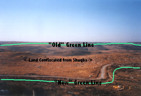
The Dusra Valley. The road (used by the Israeli military) in the picture represents Israel's version of the Green Line. In the center is a well dug by my family just before the land was confiscated.
About 1/3 of Shuqba's inhabitants fled during the 1967 war and most settled in the Al-Zarqa refugee camp in Jordan. Others went to Kuwait and other Arab countries or to the United States. Today, limited autonomy has been granted to parts of the West Bank but Shuqba is still, for all practical purposes, under Israeli control.
Shuqba is typical of most Palestinian villages. The village has a boys' school and a girls' school. A new girls' school was built only two years ago. Students can study until grade 9 there. After that, they must go to secondary schools in the nearby villages of Aboud or Na'lin.

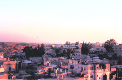
Two views from the east at sunset.The boys' school is at the top center of the second picture. The minaret of the village mosque is near the top of the first picture.
All of the inhabitants are Muslim and there is big beautiful mosque in the center of the village that was built not too long ago. The old mosque is now used as a kindergarten.

The new village mosque, rear view
Most of the villagers are farmers or laborers. Those who farm raise livestock, cereal grains, or vegetables and most families harvest olives, figs, cactus pears, etc. in the late summer and fall. As the cost of feeding livestock soars and more land is confiscated, economic self-sufficiency is on the decline and most villages are forced to turn to work in Israel or, ironically, the settlements.
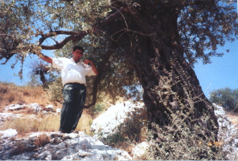
Me standing next to an ancient olive tree. This is known as a "Rumi" olive tree, referring to the fact that it has been here since Roman times.
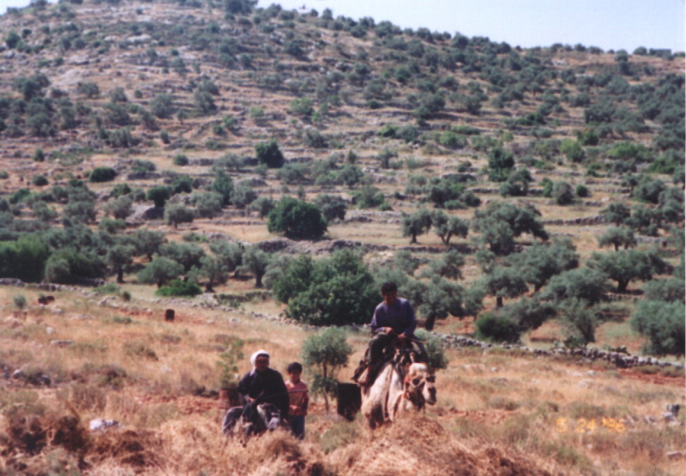
My family's olive orchard just oustide the village. Like most village lands, it is in danger of being confiscated by the Israelis. Because there are no roads nearby, it is only accessible by animal. My cousin is riding one of the few remaining camels in our region. (click on picture for closer view)
There are no factories or plants except for a small brick factory. The village received full-time electricity in the 1980's but there are no telephone lines. A few people have mobile phones. There are two main indigenous clans in the village: my father's clan, Dar ("House of") Abu Kadah, and my mother's clan, Dar Shalash. There are also three other smaller clans, the Masris (who originated in Egypt), the Hassans (who originated from a village near Jerusalem), and the Thabets (who originate from a nearby village). There is a friendly rivalry between them but they generally get along. There are almost 3,000 inhabitants living there right now. However, there thousands more Shuqbans across the world. Most live in other Arab countries (Jordan, Kuwait, Egypt, Saudi Arabia, etc.) or the eastern United States. See: People from Shuqba on the Internet
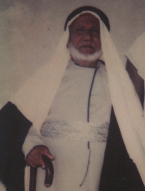
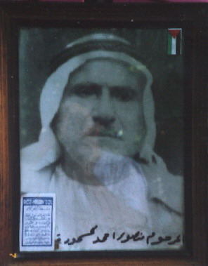
My late grandfather Mansour.
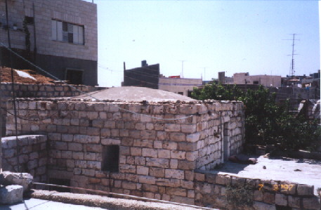
My childhood home
It consists of one room with a domed ceiling. It is part of a bigger compound built by my grandfather Mansour over 50 years ago into the side of a hill (on the left). The large stones in the building were carried one by one up a ladder and set in place. The roof is composed of rock, mud and straw. During the 1948 war, several refugee families fleeing from the Al-Lyd area rested in the rooms below and they were fed from the wheat grown in Dusra (see above).
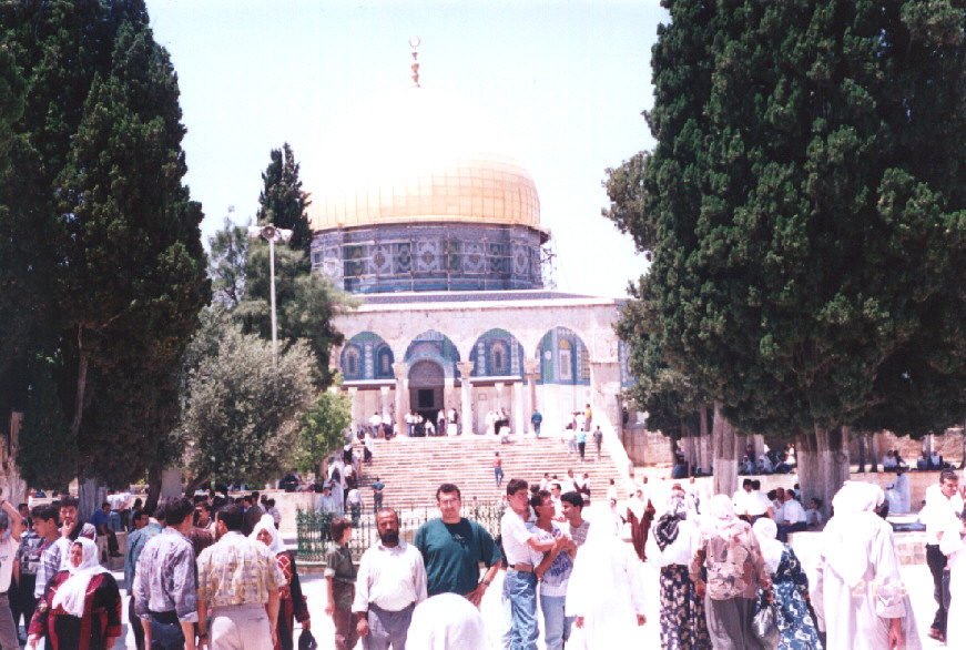
My brother Basel (green shirt) with our uncle Mahmoud outside the Dome of the Rock in Jerusalem. (click on picture for detailed view)