|

ARCHEOLOGICAL SITES
Sebastia
(Samaria)
This site dates back to 4000 BC,
and in 876 BC King Omri built his royal city atop of the hill bearing the
same name. It soon became the third capital of the northern kingdom of
Israel. In 722 BC, Sarjon II captured the city and took a number
of its people captive. The city was destroyed in 331 BC after being ravaged
by Alexander the Great. Click on any of the following to learn more about
this ancient site.
- Location
- History of the Site
- History of the Archaelogical research
on the site
- Description of the site
- Dicoveries of the site
- Tombs
- Actual situation of the site
Sebastia
(Samaria)
Location:
The modern Palestinian village of Sebastia is located
10 km north west of Nablus. The ancient royal city (Sebastia or Samaria)
lies in ruins at the hill overlooking the village from the west at an altitude
of 430m above sea level. One can reach Sebastia from two directions via
Nablus-Jenin road: preferably through the western gate which leads to the
colonnaded street; or through the modern village by a road that leads to
the forum. The city benefited from its location at the junction of two
important ancient trade routes: the Nablus-North of Palestine route, and
the Palestinian coast-Jordan valley route. It also benefited from the fertile
plateaus around it. This strategic location has compensated the city for
its scarce water resources.
History of the site:
Archaeological excavations at Sebastia indicate that it
was first settled during the Chalcolithic period (4000 BC). It did not,
however, gain political importance until 876 BC when King Omri built his
royal city on it. He named the city Samaria after the man who sold him
the hill. It is said that this man, shomer or Samer, sold the hill for
two talents of silver. Samaria became the third capital of the northern
kingdom of Israel after Tell Balata (Shechem) and Tell El Far'ah-north
(Tirzah). The city gave its name to the kingdom and the region as a whole.
During the reign of Urba'am II 784-748 BC, both the city and kingdom of
Samaria flourished. According to the Old Testament the kingdom expanded
greatly; its borders extended as far as Aleppo in the north and Aqaba in
the south (II Kings 14:23-29).
In 722 BC, Sarjon II occupied the city and took a great
number of its people captive (about 30,000 prisoners). This represented
one third of the inhabitants of the region. He expelled them to Assur and
replaced them by settlers loyal to him from the distant countries of the
Assyrian Empire. Those banished people have come to be known in the Jewish
traditions as the "Ten Lost Tribes."
 The
city was destroyed in 331 BC after been occupied by Alexander the Great.
It was rebuilt as a Hellenistic city, and Macedonian soldiers settled there.
Its inhabitants, the Samaritans, were expelled to Shechem (Nablus). The
Hazmonian leader John Hercanus destroyed Samaria in 108 BC. After the Roman
occupation of the city in 63 BC, the Roman Emperor Augustine gave it as
a gift to Herod the Great, who rebuilt the city and renamed it Sebastia
in honor of his lord Augustine. Herod lodged his followers, the atheists
in the city, but it was destroyed again by the Jews during their revolt
against Rome between 66 and 70 AD. The
city was destroyed in 331 BC after been occupied by Alexander the Great.
It was rebuilt as a Hellenistic city, and Macedonian soldiers settled there.
Its inhabitants, the Samaritans, were expelled to Shechem (Nablus). The
Hazmonian leader John Hercanus destroyed Samaria in 108 BC. After the Roman
occupation of the city in 63 BC, the Roman Emperor Augustine gave it as
a gift to Herod the Great, who rebuilt the city and renamed it Sebastia
in honor of his lord Augustine. Herod lodged his followers, the atheists
in the city, but it was destroyed again by the Jews during their revolt
against Rome between 66 and 70 AD.
In an effort to counterbalance the pressure of Nablus,
whose people were opposed to Rome, the Roman governor of Palestine, Sebtimus
Severos, rehabilitated Sebastia in the second century AD, adding many new
buildings to it. In 200 AD the city was granted the status of a Roman city
and enjoyed the right to issue its own currency. After the spread of Christianity
in Palestine and the Roman Empire during the forth century, the city started
to weaken. It is thus possible to divide the history of Sabastia into the
following periods:
Omri to the Assyrian conquest (876-724 BC)
This era is represented at the site by layers 1-6. The
city in this period consisted of a castle at the top of the hill (Acropolis)
which included the Royal Palace and its annexes. It was surrounded by a
casemate wall 1.6m thick; this was the Upper city. The lower city spread
on the western slopes of the hill. Archaeologists have not yet excavated
the whole city which is believed to have extended from the western gate
to the forum in the east;. it was approximately 800 meters long. Researchers
do not agree on the surface area of the city at that time. While some believe
that it did not exceed 18.5 dunums, others think that it had the same size
of the Roman city (160 dunums).
Assyrian conquest to the Hellenistic period (724-63
BC.)
This is represented at the site by layers 7 and 8, including
the remains of the Assyrian, Babylonian, Persian, and the Hellenistic eras.
 During
the Hellenistic era, the older walls were strengthened by circular towers.
Excavations have revealed two of these towers near the south-western corner
of the castle; they were wrongly dated to the Israelite period (Late Iron
Age). The second excavation unveiled a third tower on the north-eastern
side of the wall. Other parts of the Hellenistic wall, which was destroyed
by John Herkanios, are still visible in the western gate. The towers of
the gate were built on a square basis of Hellenistic time. It is possible
that the Hellenistic gate of the city was here too. During
the Hellenistic era, the older walls were strengthened by circular towers.
Excavations have revealed two of these towers near the south-western corner
of the castle; they were wrongly dated to the Israelite period (Late Iron
Age). The second excavation unveiled a third tower on the north-eastern
side of the wall. Other parts of the Hellenistic wall, which was destroyed
by John Herkanios, are still visible in the western gate. The towers of
the gate were built on a square basis of Hellenistic time. It is possible
that the Hellenistic gate of the city was here too.
The Roman Period (63 BC-324 AD)
The city reached its climax during the Roman period. Most
of the remaining ruins of Sebastia date back to this period, particularly
the reign of Herod the Great 37-44 BC. The city became an ideal Roman city,
including all the components of a city: walls, gates, towers, collonaded
streets, temples, a theater, a stadium, a Forum, Hippodrome, Basilca, etc.
History of archaeological research on the site:
The first expedition to the site was that of the Harvard
University from 1908 to 1910, first under the direction of the German scholar
G. Schumacher, and then the American archaeologist C.S. Fisher. This excavation
concentrated on the top of the hill (Acropolis) and revealed the western
part of the castle and the casemate walls dating back to the reign of king
Omri (ninth century BC). It also exposed parts of the Roman wall, western
gate, Hellenistic tower, 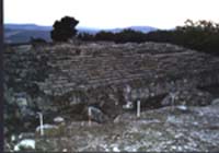 Augustus
temple, the Forum, the Basilica, and the theater as well as some private
houses and manuscripts. Augustus
temple, the Forum, the Basilica, and the theater as well as some private
houses and manuscripts.
The second archaeological expedition to the site was the
combined mission of the Harvard University, the Palestine Exploration Fund,
the Hebrew University, and others under the supervision of G.M. Crawfot
(1931-1935). This mission cleared the castle and discovered the collonaded
street, the forum, and the stadium. The Curi temple, the theater, a group
of Roman tombs, the Roman hydraulic system and the Byzantine church were
also discovered.
Between 1965-1967, the Jordanian Department of Antiquities
conducted a small excavation of the site. This was under the supervision
of F. Zayadin. The work was concentrated in the region of the theater,
the collonaded street, the western gate, and the temple of Augustus. A
tomb of the Late Iron Age was discovered as well. In 1968, J.B. Hennessy
conducted an excavation in the western part of the hill. He discovered
several layers of Hellenistic and Roman ages. Archaeologists faced real
problems in distinguishing the different layers at Sebastiah. This is due
to the fact that the city was destroyed several times. Builders often destroyed
existing buildings and used their materials in new ones; they deepened
the foundations to reach bedrock. As a result, things are currently mixed
up at the site.
Description of the site
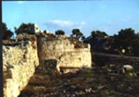
The Western Gate And The City Wall
The first thing that attracts the attention of the visitors
of the city, when approaching the city from the western gate, is the gate
itself. It is a wide door supported by two circular towers. The diameter
of each is 14 meters. These were built in the Herodion period. They were
built on a square base dating to Hellenistic time. These towers are still
standing at a height of 8-11m. The city wall that we see today was built
around the end of the second or the beginning of the third century BC.
It is irregular and supported by a number of circular towers. The wall
is 1 km long from east to west and a little less from north to south. Only
a small part of it is still standing; this is because a lot of the stones
of the wall were reused in the construction of the Roman city of Nablus
in first century AD.
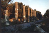
The Collonaded Street
The
collonaded Street starts at the western gate; its width at this point is
12.5m and decreases progressively to the end. It dates back to the end
of the second century and the beginning of the third century AD. It extends
to a distance of 800m in an eastern direction. It extends at the eastern
gate and the public yard. Six hundred stony pillars stand on both sides
of the street. The height of each, with the crown, is 5.5m. Only two of
these crowns are found in the site, whereas the rest of the crowns have
disappeared. At one time, these pillars carried a roof. Two rows of shops,
on both sides of the street, served as a market in the Roman era.
The internal plan of the city does not differ from any
other Roman city. It consists of straight parallel streets, branching from
a public yard. The city includes the following public buildings:
Via the pillars street, the visitor can reach the forum.
Its dimensions are 128x72.5m. It is used today as a parking lot for visitors
It includes a number of venires shops and tourist restaurants. Some of
its foundations are built on the rocks at a depth of 4-6m. These were leveled
by artificial fillings supported by giant terraces. The forum is closed
from the four sides by arches. It was originally surrounded by pillars.
Nowadays, only seven out of twenty-four pillars of the western side are
left. The rest of the pillars disappeared, and only their bases remained.
At the western wall, there is a door leading to the Basilca which is connected
with the forum.
The archeologist did not unveil the totality of the Basilca.
However, its plan is clear. It is 68 m long, and its width is 32.6m. Three
rows of pillars divide the Basilca into a yard and vestibules. Some of
these pillars are still found, but most of it consist only of the bases.
The height of the pillars is 6 m. Two of them bear Coronation Crowns. On
the northern side of the Basilca exists the altar, crook, and four chairs.
Most of the exciting seen remnants belong to the second century after Christ
There are also remnants of Herodion time. There is a canal flowing under
the southern extremity of the wall, beside the Basilca, and is used to
bring water to the city. In earlier periods, the city depended on the rainfall
harvest in the canals and cisterns.
Near the northern end of the Basilca, there is a narrow
earthy path leading to the Roman theater. It is a small theater of 65 m
in diameter. Its lower part contains 14 rows of desks. It is divided into
six sections of desks making seven groups of assemblies. The theater was
built in the first quarter of the third century AD.
At the eastern side of the theater, there lies a magnificent
tower that was built in the Alexander era. Its diameter is 13 m and is
still standing in a good condition at a height of 8.5 m. It is formed of
19 well built blocks. It is totally made of corner stones. Perhaps, it
is the greatest ruin left from the Hellenic era (the end of the 4th
century BC) in Palestine.
Near the eastern end of the theater, an earthy road ascends
in a western direction, to reach Augustine Temple and Amri Castle, on the
summit that overlooks the whole city and the Mediterranean Sea. There the
great temple, which was built by Herod honoring and commemorating the Roman
emperor Augustine, stands. The temple is composed of a large front yard
and a building of 35 x 24 m in dimension. This yard is leveled and its
dimensions are: 83 x 72 m. Both the building and the yard are found in
north-south orientation. The outer northern wall is still standing at a
height of 7 m. Its original height was about 15 m. There is a wide stair
leading to the front yard of the temple which stands at a height at about
4.4 m above the yard.
It is possible to enter the temple through a loggia. The
foundations of the temple were built on rocks at a depth of 9 m. What is
left from the walls of the temple indicates that it was built in the Herodion
period. The remaining stones in the walls are traditional Herodion stones
with protruding margins at the outer faces. The temple is divided into
a grand hall and two pillared aisles. In the second century AD, the temple
was rebuilt according the original plan. However, there have been some
extension added to the length. The stairs that are found to clay and the
alter were also added. Beside the altar exists the base of giant statue.
Perhaps that was for the Emperor Augustine.
To the North of the Augustine Temple, a temple for the
goddess Curi was built during the Herodion period. Its dimensions are:
36 x 15.5 m. with its base dimensions at 84 x 45 m. Perhaps, it was surrounded
by pillars. Only the foundations of this temple were unveiled. This was
destroyed by John Hercanus and was built on the ruins of an earlier temple
belonging to the third century BC. It was dedicated the Greek goddess Isis.
A few meters to the South of the Augustine temple appears
the walls of the Castle Palace. This belongs to the period of King Amri
and his son Ihab. It is believed that this temple was specified for the
worship of the Canaanite's gods Baa'l and Ishtarot. According to the Torah,
Ihab built this temple to content his Phoenician wife Jezebel.
The prospectors have discovered, in the zone of the palace,
a statue for the Phoenician goddess Ishtarot. The castle and the palace
were built of refined stones, a skill the Samaritans learnt to do from
the Phoenicians.
Also a beautiful group of ivory sculptures and manuscripts
were discovered at this site.
The stadium is found in the north eastern part of the
city. Some of its pillars appeared before the first excavations had started.
One of its buildings belongs to the Herodion ages while the second is related
to the second century. It is built in the Corinthian style. Near the stadium,
a statue for the god Kori and a manuscript written in Greek were discovered.
Other Discoveries at the Site
Few ruins from the proceeding periods exist. There is
a church in the lower city, and another subcity in the upper section on
the southern part of the hill. The church, existing in the main yard of
the present village, was built during the Crusader's time at about 1160
AD. This was converted to a mosque in the time of Saladin. It is known
today as Al-Nabi Yahia mosque, and this is in reference to John the Baptist
who is thought to be buried here. The church on the hill is also named
after him. It is believed that his head was hidden in this church. The
church also dates to the Crusaders period and stands on the ruins of a
Basilica church belonging to the Byzantine era. It consists of a main hall
and two pillared vaults on the left and right sides.
Numerous coins have been discovered in Sabastia. Most
of these belong to the period of Batlimos-3rd century BC and
to the Siloqian period in the second century. Other coins date to the Hezmonian
and Herodion era-1st century AD. Coins that were issued by Sebastia
itself in the Roman era were also unveiled, in addition to many imported
pottery belonging to Herodion and other periods. In addition to many imported
pottery belonging to Herodion and other periods, the discoveries include
Byzantine, Arabic, and Crusaders coins.
The Tombs
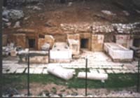 In
the southern corner of Sabastia village, there is a Roman cemetery belonging
to the end of the second and the beginning of the third century. It is
sculptured in the rock and adorned externally by plaster. Other sarcophaguses
were also discovered. In the eastern part of the village, Roman tombs were
also discovered. In these tombs numerous glass utensils and jewelry were
found. Potter utensils, particularly lamps belonging to the 2nd
century which continued to be used in the 3rd century, were
discovered at the site. In
the southern corner of Sabastia village, there is a Roman cemetery belonging
to the end of the second and the beginning of the third century. It is
sculptured in the rock and adorned externally by plaster. Other sarcophaguses
were also discovered. In the eastern part of the village, Roman tombs were
also discovered. In these tombs numerous glass utensils and jewelry were
found. Potter utensils, particularly lamps belonging to the 2nd
century which continued to be used in the 3rd century, were
discovered at the site.
Actual Situation Of The Site
In spite of the negligence that affected Sabastia during
the long Israeli occupation, the site remains highly attractive. It is
one of the biggest archeological sites in the West Bank. In contrast to
its potential and its beauty, its visitors are few. However, its capacities
to attract tourism is very important. What it lacks is the development
of the available services. Also, provision of pamphlets and programs that
encourage visiting the site need to be created. This brochure is a trial
in that direction. No doubt, there is a need to ensure the protection for
the site to prevent the abuse of the treasures of this archeological site.
It may be necessary to apply reasonable entrance fees that will help develop
the level of services at the site.
|